


In keeping with the mandate of mapping geologic hazards, the GhEGS Team conducted Vulnerability and Risk Assessment (VRA) and Updating of the 1:10,000-scale Geohazard Maps in the Municipality of Maria in Siquijor Province on March 2022 and the Municipality of La Libertad in the Province of Negros Oriental last May to June 2022.
Coastal Geohazard Mapping and Assessment (CGMA) was likewise undertaken in the Municipalities of Oslob, Santander, and Samboan, Cebu last March 2022; the City of Toledo, Cebu last April to May 2022; and the Municipalities of San Remigio, Medellin, and Daanbantayan, Cebu in June to July 2022.
A detailed Sub-surface Assessment was also undertaken in the Municipality of Alcoy, Cebu last April to May 2022.
Outputs for these activities are Risk Exposure Maps (REMs) for the VRA, updated Geohazard Maps, Coastal Vulnerability Maps for the CGMA, and Karst Subsidence Vulnerability Maps for the Detailed Sub-surface Assessment.
These maps are useful tools for the Local Government Units (LGUs) concerned in formulating their Comprehensive Land Use Plans (CLUPs), Disaster Risk Reduction and Management (DRRM) and Contingency Plans as these maps indicate the susceptibilities of the LGUs to Rain-induced landslides and floods; coastal flooding and erosion; and karst subsidence hazards.
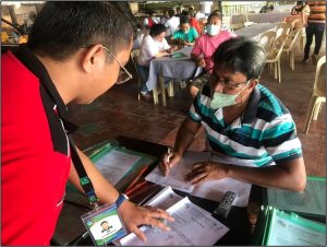
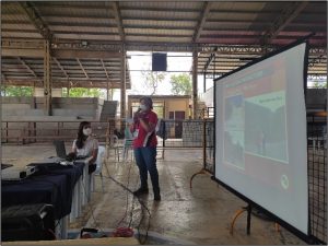
Exit conferences were conducted in the VRA areas and IEC materials (posters and pamphlets on landslides, flooding and sinkholes) were distributed to local officials for their information dissemination to their constituents.
Following are photos of the GhEGS field activities:
Photo 1. Barangay Captain of Bogo, Maria, Siquijor, Hon. Tessie Calimpon, was interviewed about recent geohazard events in their barangay during the courtesy call of the MGB-7 VRA Team.
Photo 2. A localized landslide is observed along this steep slope cut at Purok 3 – Santan, Barangay Pisong B, Maria, Siquijor. It is underlain by highly weathered and fractured volcanic flows. The rest of the slopes are underlain by deeply weathered clastic rocks that are also prone to landslide hazards. (9⁰ 12’ 05.7” N, 123⁰ 37’ 20.8” E)
|
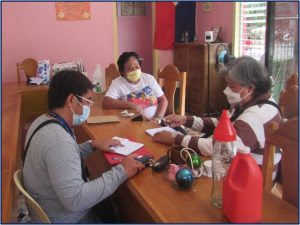
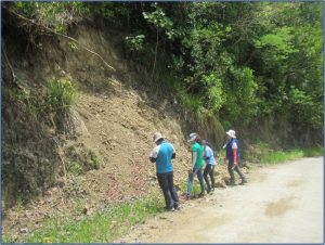
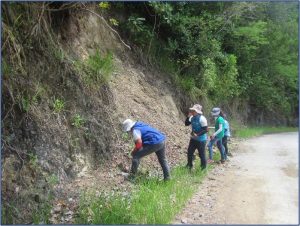
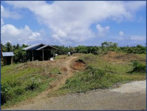
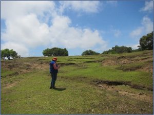
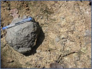
Photo 3. The undulating topography at Purok 2 – Santan, Barangay Logucan, Maria, Siquijor is influenced by the underlying materials that are highly weathered, oxidized volcanic rocks (shown in detail at right). Numerous tension cracks, aggravated by the erosive force of surface runoff during heavy rainfall, are indicative of the area’s susceptibility to landslide. (9⁰ 9’ 23.1” N, 123⁰ 39’ 19.7” E)
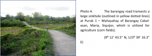
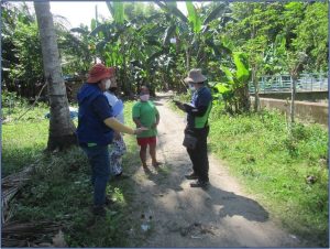
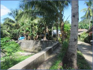
Photo 5. Flood-prone area at Purok 1 – Gumamela, Barangay Sawang, Maria, Siquijor, where 7 houses are affected by overflow from Tarolinan River. Flooding is aggravated by clogging of the cross-drain culvert beneath the highway, towards the river mouth (indicated by the arrow). (9⁰ 10’ 47.0” N, 123⁰ 39’ 32.0” E)
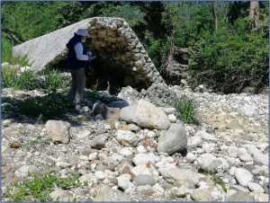
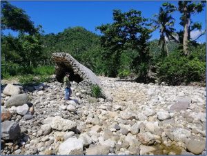
Photo 6. Damaged flood control structure at Sitio Relocation (formerly Bloke 1), Barangay Solonggon, La Libertad, Negros Oriental along the Libertad River. This is near the spillway leading to Barangay Mandapaton.
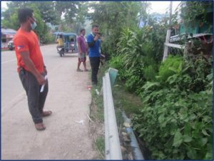
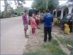
Photo 7. A total of 7 houses, including that of the Butalid and Calidkid households, are affected by about 1.0-meter-high flood at Zone 7, Barangay Cantupa, La Libertad, Negros Oriental. The area lacks an appropriate drainage canal that connects towards the creek.
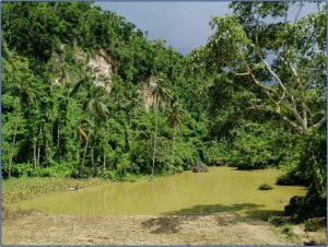
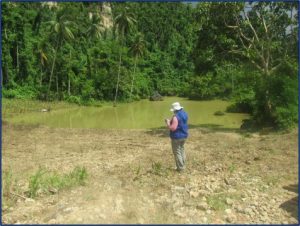
Photo 8. Limestone escarpment with solution sinkhole below is observed at Sitio Sugka, La Libertad, Negros Oriental along the road to Sitio Mantuguis and to Barangays Owacan and Mahanlud, Jimalalud.
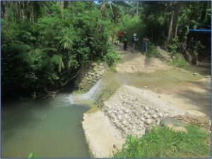
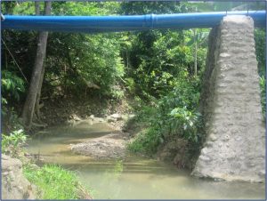
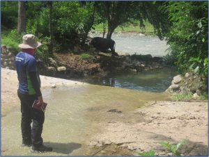
Photo 9. This section of the access road to Sitio Mambulotan is traversed by an unnamed tributary of Libertad River at Sitio Bunakan Ilaya, Barangay Mandapaton, La Libertad. Negros Oriental. The road is not passable during inclement weather due to flooding from the creek.
Photo 10. This area near Libertad River at Sitio Polo, Barangay Manghulyawon, La Libertad, Negros Oriental, was once part of the river channel. Construction of the river dike along the present active channel has completely cut this area off from the river and now serves as an agricultural plot on the floodplain.
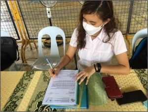
Pictures during the Exit Conference in La Libertad, Negros Oriental
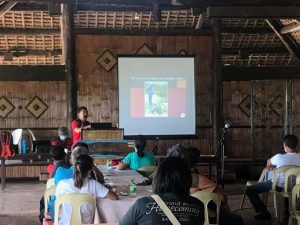
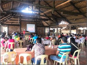
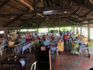
Pictures during the Exit Conference in La Libertad, Negros Oriental
Pictures during the Exit Conference in Maria, Siquijor
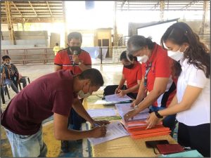
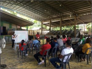
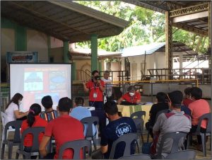
Pictures during the Exit Conference in Maria, Siquijor
Coastal Geohazard Assessment in Toledo City, Cebu
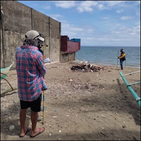 Photo 1. Beach profiling along the sandy beach area of Sitio Sambag, Barangay Ibo, Toledo City, Cebu
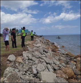
Photo 2. Coastal area of Sitio Lawis, Barangay Ibo, Toledo City, Cebu to undergo development in the near future.